Podickory Point Community
Maps and Plats of Podickory Point and Creek
Podickory Point Subdivision Plats
In addition to our own Map Room, did you know that you can obtain and download the original Podickory Subdivision Plats from the Maryland State Archives Web Site?
Copy and Paste the following URL into your Internet Browser-
http://www.mdarchives.state.md.us/
There is a subsection on their Menu named Plats.net. (www.plats.net) When you point your browser to that site you will get a pop-up message sign-in screen to enter the Plats.net page. The public User sign-on is "plato" and the public password is "plato# "
It is best to register (free) with Maryland State Archives and they will email you this information as well. The MSA website actually allows zoom features to these plats and you will be able to download a much better quality digital image to your own computer from the Archives website.
References you will need to locate Podickory Point Plats are Plat # 1711 for Section 1 Bay Front Terrace, and Plat 1723 for Section 2 Harbor Drive. Minor subdivisions and later revisions are also available.
Anne Arundel County Dept of Public Works
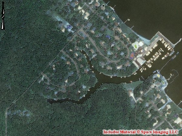
Interactive mapping and geographic information for Anne Arundel County is now available from a County web site. The web site allows you to view or print topographic maps
>> Satellite imagery taken in 2004
>> Aerial photography taken in 2002
and more.
Anne Arundel County Office of Planning and Zoning
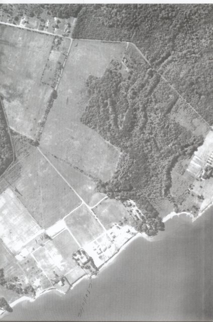
The Anne Arundel County Office of Planning and Zoning maintains paper copies of aerial photos for various years and access to digital aerial photos for recent years. Aerial photograph appointments for multiple years of photos can be scheduled for Tuesdays and Thursdays and should be made at least one week in advance. Historic aerial photos among the archived map room collection go back to 1952. Detailed location information (such as tax map, block and parcel numbers, address, or ADC map location) and a site description is required when making appointments to view or obtain paper copies of these aerial photos.
Email us
PPCA Board (ppcaboardpresident@gmail.com)
Links that may help you:
MSA - Plats and Maps - Maryland State Archives
Maryland State Archives
Photo Credit: Anne Arundel County, MD Engineering Records

- Advertise Here!
-
Promote Your Business or Product for $10/mo

For just $10/mo you can promote your business or product directly to nearby residents. Buy 12 months and save 50%!
