PATA History Pages
Map of the 1993 Proposed
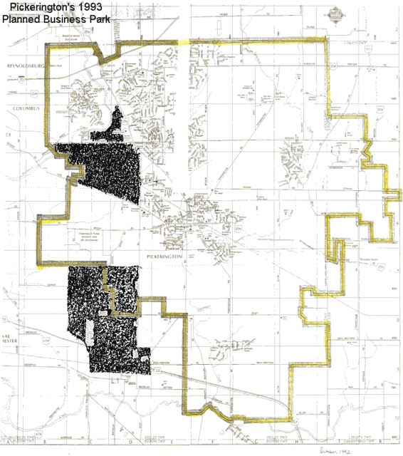
The map shows the PLSD boundaries and where Business Parks to be
The above map indicates, within the shaded portion, the City of Pickerington’s 1993 Comprehensive Land Use Plan’s locations for a “Business Park”. The boundary line is an indication of the dimensions of the Pickerington Local School District.
Even in 1993, officials were attempting to locate the needed commercial diversity to our tax base outside our PLSD boundaries.
The northern location is now the site of the homes behind the Kroger store and on the lands to the west. Many may also remember how a referendum effort on that re-zoning was also thwarted.

- Advertise Here!
-
Promote Your Business or Product for $10/mo

For just $10/mo you can promote your business or product directly to nearby residents. Buy 12 months and save 50%!
